Категория:Локации для совместных боёв — различия между версиями
(Метка: визуальный редактор отключён) |
K35353 (обсуждение | вклад) (Метка: визуальный редактор отключён) |
||
| Строка 2: | Строка 2: | ||
{| style="border-spacing: 40px; border: 2px solid darkgray;" | {| style="border-spacing: 40px; border: 2px solid darkgray;" | ||
|- | |- | ||
| − | ![[File:MapIcon Ground AbandonedFactory.jpg|300x300px|link= | + | ![[File:MapIcon Ground AbandonedFactory.jpg|300x300px|link=Заброшенный завод (Сухопутные_войска)]]<br> |
| − | | style="vertical-align:top" |[[File:CountryIcon SUN.png|link=|top]] [[ | + | | style="vertical-align:top" |[[File:CountryIcon SUN.png|link=|top]] [[Заброшенный завод (Сухопутные_войска)|<span style="font-size: 18px; font-weight: 800;">Заброшенный_завод_</span>]]<br>Расположение: Россия<br> |
''[All Descriptions need expanding]''<br> | ''[All Descriptions need expanding]''<br> | ||
|- | |- | ||
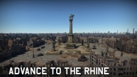
| − | ![[File:MapIcon Ground AdvancetotheRhine.jpg| | + | ![[File:MapIcon Ground AdvancetotheRhine.jpg|200x200px|border|link=|]] |
| − | | style="vertical-align:top" |[[File:CountryIcon NDE.png|link=|top]] <span style="font-size: 18px; font-weight: 800;"> | + | | style="vertical-align:top" |[[File:CountryIcon NDE.png|link=|top]] <span style="font-size: 18px; font-weight: 800;">Переправа через Рейн</span><br>Расположение: Кёльн, Германия<br> |
Teams fight for control over the bridges leading to the other side of the Rhine.<br> | Teams fight for control over the bridges leading to the other side of the Rhine.<br> | ||
|- | |- | ||
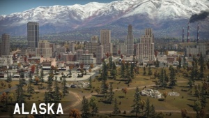
![[File:MapIcon Ground Alaska.jpg|300x300px|border|link=|]] | ![[File:MapIcon Ground Alaska.jpg|300x300px|border|link=|]] | ||
| − | | style="vertical-align:top" |[[File:CountryIcon USA.png|link=|top]] <span style="font-size: 18px; font-weight: 800;"> | + | | style="vertical-align:top" |[[File:CountryIcon USA.png|link=|top]] <span style="font-size: 18px; font-weight: 800;">Аляска</span><br>Расположение: Аляска, США<br> |
[Description]<br> | [Description]<br> | ||
|- | |- | ||
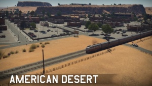
![[File:MapIcon Ground AmericanDesert.jpg|300x300px|border|link=|]] | ![[File:MapIcon Ground AmericanDesert.jpg|300x300px|border|link=|]] | ||
| − | | style="vertical-align:top" |[[File:CountryIcon USA.png|link=|top]] <span style="font-size: 18px; font-weight: 800;"> | + | | style="vertical-align:top" |[[File:CountryIcon USA.png|link=|top]] <span style="font-size: 18px; font-weight: 800;">Американская пустыня</span><br>Расположение: Аризона, США<br> |
[Description]<br> | [Description]<br> | ||
|- | |- | ||
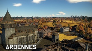
![[File:MapIcon Ground Ardennes.jpg|300x300px|border|link=|]] | ![[File:MapIcon Ground Ardennes.jpg|300x300px|border|link=|]] | ||
| − | | style="vertical-align:top" |[[File:CountryIcon BEL.png|link=|top]] <span style="font-size: 18px; font-weight: 800;"> | + | | style="vertical-align:top" |[[File:CountryIcon BEL.png|link=|top]] <span style="font-size: 18px; font-weight: 800;">Арденны</span><br>Расположение: Бастонь, Бельгия<br> |
[Description]<br> | [Description]<br> | ||
|- | |- | ||
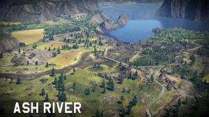
![[File:MapIcon Ground AshRiver.jpg|300x300px|border|link=]] | ![[File:MapIcon Ground AshRiver.jpg|300x300px|border|link=]] | ||
| − | | style="vertical-align:top" |[[File:CountryIcon IRL.png|link=|top]] <span style="font-size: 18px; font-weight: 800;"> | + | | style="vertical-align:top" |[[File:CountryIcon IRL.png|link=|top]] <span style="font-size: 18px; font-weight: 800;">Пепельная река</span><br>Расположение: Ирландия<br> |
A battle between two armies spread across the ground, the sea and the air. Thousands of people are fighting for control of the cliff-filled coast.<br> | A battle between two armies spread across the ground, the sea and the air. Thousands of people are fighting for control of the cliff-filled coast.<br> | ||
|- | |- | ||
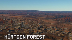
![[File:MapIcon Ground HurtgenForest.jpg|300x300px|border|link=]] | ![[File:MapIcon Ground HurtgenForest.jpg|300x300px|border|link=]] | ||
| − | | style="vertical-align:top" |[[File:CountryIcon NDE.png|link=|top]] <span style="font-size: 18px; font-weight: 800;"> | + | | style="vertical-align:top" |[[File:CountryIcon NDE.png|link=|top]] <span style="font-size: 18px; font-weight: 800;">Хюртгенский лес</span><br>Расположение: Аахен, Германия<br> |
Teams fight for control over a strategically important point located in Hürtgen Forest.<br> | Teams fight for control over a strategically important point located in Hürtgen Forest.<br> | ||
|- | |- | ||
![[File:MapIcon Ground Berlin.jpg|300x300px|border|link=]] | ![[File:MapIcon Ground Berlin.jpg|300x300px|border|link=]] | ||
| − | | style="vertical-align:top" |[[File:CountryIcon NDE.png|link=|top]] <span style="font-size: 18px; font-weight: 800;"> | + | | style="vertical-align:top" |[[File:CountryIcon NDE.png|link=|top]] <span style="font-size: 18px; font-weight: 800;">Берлин</span><br>Расположение: Берлин, Германия |
[Description]<br> | [Description]<br> | ||
|- | |- | ||
|[[File:MapIcon Ground Carpathians.jpg|300x300px|border|link=]] | |[[File:MapIcon Ground Carpathians.jpg|300x300px|border|link=]] | ||
| − | | style="vertical-align:top" |[[File:CountryIcon POL.png|link=|top]] <span style="font-size: 18px; font-weight: 800;"> | + | | style="vertical-align:top" |[[File:CountryIcon POL.png|link=|top]] <span style="font-size: 18px; font-weight: 800;">Карпаты</span><br>Расположение: Польша<br> |
Two armies ran into a fight for possession of the mountain pass.<br> | Two armies ran into a fight for possession of the mountain pass.<br> | ||
|- | |- | ||
|[[File:MapIcon Ground EasternEurope.jpg|300x300px|border|link=]] | |[[File:MapIcon Ground EasternEurope.jpg|300x300px|border|link=]] | ||
| − | | style="vertical-align:top" |[[File:CountryIcon SUN.png|link=|top]] <span style="font-size: 18px; font-weight: 800;"> | + | | style="vertical-align:top" |[[File:CountryIcon SUN.png|link=|top]] <span style="font-size: 18px; font-weight: 800;">Восточная Европа</span><br>Расположение: Украина<br> |
Warring armies are spoiling for a fight. only a small town is dividing them. It seems that no stone will be left unturned.<br> | Warring armies are spoiling for a fight. only a small town is dividing them. It seems that no stone will be left unturned.<br> | ||
|- | |- | ||
|[[File:MapIcon Ground EuropeanProvince.jpg|300x300px|border|link=]] | |[[File:MapIcon Ground EuropeanProvince.jpg|300x300px|border|link=]] | ||
| − | | style="vertical-align:top" |[[File:CountryIcon SUN.png|link=|top]] <span style="font-size: 18px; font-weight: 800;"> | + | | style="vertical-align:top" |[[File:CountryIcon SUN.png|link=|top]] <span style="font-size: 18px; font-weight: 800;">Европейская провинция</span><br>Расположение: Украина<br> |
|- | |- | ||
|[[File:MapIcon Ground Finland.jpg|300x300px|border|link=|]] | |[[File:MapIcon Ground Finland.jpg|300x300px|border|link=|]] | ||
| − | | style="vertical-align:top" |[[File:CountryIcon FIN.png|link=|top]] <span style="font-size: 18px; font-weight: 800;"> | + | | style="vertical-align:top" |[[File:CountryIcon FIN.png|link=|top]] <span style="font-size: 18px; font-weight: 800;">Финляндия</span><br>Расположение: Кивиниеми, до войны в Финляндии (Лосево, Современная Россия)<br> |
In these frosty parts of the world, a war is like a stern test that needs to be passed in order to win.<br> | In these frosty parts of the world, a war is like a stern test that needs to be passed in order to win.<br> | ||
|- | |- | ||
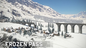
|[[File:MapIcon Ground FrozenPass.jpg|300x300px|border|link=]] | |[[File:MapIcon Ground FrozenPass.jpg|300x300px|border|link=]] | ||
| − | | style="vertical-align:top" |[[File:CountryIcon NDE.png|link=|top]] <span style="font-size: 18px; font-weight: 800;"> | + | | style="vertical-align:top" |[[File:CountryIcon NDE.png|link=|top]] <span style="font-size: 18px; font-weight: 800;">Ледяной перевал</span><br>Расположение: Австрия<br> |
[Description]<br> | [Description]<br> | ||
|- | |- | ||
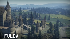
|[[File:MapIcon Ground Fulda.jpg|300x300px|border|link=]] | |[[File:MapIcon Ground Fulda.jpg|300x300px|border|link=]] | ||
| − | | style="vertical-align:top" |[[File:CountryIcon DEU.png|link=|top]] <span style="font-size: 18px; font-weight: 800;"> | + | | style="vertical-align:top" |[[File:CountryIcon DEU.png|link=|top]] <span style="font-size: 18px; font-weight: 800;">Фульда</span><br>Расположение: Гессен, Германия<br> |
[Description]<br> | [Description]<br> | ||
|- | |- | ||
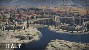
|[[File:MapIcon Ground Italy.jpg|300x300px|border|link=]] | |[[File:MapIcon Ground Italy.jpg|300x300px|border|link=]] | ||
| − | | style="vertical-align:top" |[[File:CountryIcon ITA.png|link=|top]] <span style="font-size: 18px; font-weight: 800;"> | + | | style="vertical-align:top" |[[File:CountryIcon ITA.png|link=|top]] <span style="font-size: 18px; font-weight: 800;">Италия</span><br>Расположение: Калабрия, Италия<br> |
[Description]<br> | [Description]<br> | ||
|- | |- | ||
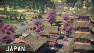
|[[File:MapIcon Ground Japan.jpg|300x300px|border|link=]] | |[[File:MapIcon Ground Japan.jpg|300x300px|border|link=]] | ||
| − | | style="vertical-align:top" |[[File:CountryIcon JPN.png|link=|top]] <span style="font-size: 18px; font-weight: 800;"> | + | | style="vertical-align:top" |[[File:CountryIcon JPN.png|link=|top]] <span style="font-size: 18px; font-weight: 800;">Япония</span><br>Расположение: Япония<br> |
The beautiful rual countryside of japan, explore the fruitful cherry blossoms.<br> | The beautiful rual countryside of japan, explore the fruitful cherry blossoms.<br> | ||
|- | |- | ||
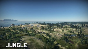
|[[File:MapIcon Ground Jungle.jpg|300x300px|border|link=]] | |[[File:MapIcon Ground Jungle.jpg|300x300px|border|link=]] | ||
| − | | style="vertical-align:top" |[[File:CountryIcon GBR.png|link=|top]] <span style="font-size: 18px; font-weight: 800;"> | + | | style="vertical-align:top" |[[File:CountryIcon GBR.png|link=|top]] <span style="font-size: 18px; font-weight: 800;">Джунгли</span><br>Расположение: Гуадалканал , Соломоновские острова<br> |
[Description]<br> | [Description]<br> | ||
|- | |- | ||
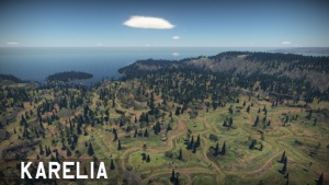
|[[File:MapIcon Ground Karelia.jpg|300x300px|border|link=]] | |[[File:MapIcon Ground Karelia.jpg|300x300px|border|link=]] | ||
| − | | style="vertical-align:top" |[[File:CountryIcon SUN.png|link=|top]] <span style="font-size: 18px; font-weight: 800;"> | + | | style="vertical-align:top" |[[File:CountryIcon SUN.png|link=|top]] <span style="font-size: 18px; font-weight: 800;">Карелия</span><br>Расположение: Карелия, Россия<br> |
[Description]<br> | [Description]<br> | ||
|- | |- | ||
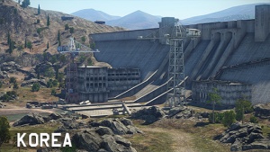
|[[File:MapIcon Ground Korea.jpg|300x300px|border|link=]] | |[[File:MapIcon Ground Korea.jpg|300x300px|border|link=]] | ||
| − | | style="vertical-align:top" |[[File:CountryIcon KOR.png|link=|top]] <span style="font-size: 18px; font-weight: 800;"> | + | | style="vertical-align:top" |[[File:CountryIcon KOR.png|link=|top]] <span style="font-size: 18px; font-weight: 800;">38-я Параллель</span><br>Расположение: Северная Корея |
[Description]<br> | [Description]<br> | ||
|- | |- | ||
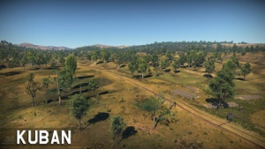
|[[File:MapIcon Ground Kuban.jpg|300x300px|border|link=]] | |[[File:MapIcon Ground Kuban.jpg|300x300px|border|link=]] | ||
| − | | style="vertical-align:top" |[[File:CountryIcon SUN.png|link=|top]] <span style="font-size: 18px; font-weight: 800;"> | + | | style="vertical-align:top" |[[File:CountryIcon SUN.png|link=|top]] <span style="font-size: 18px; font-weight: 800;">Кубань</span><br>Расположение: Крымск, Россия<br> |
[Description]<br> | [Description]<br> | ||
|- | |- | ||
|[[File:MapIcon Ground Kursk.jpg|300x300px|border|link=]] | |[[File:MapIcon Ground Kursk.jpg|300x300px|border|link=]] | ||
| − | | style="vertical-align:top" |[[File:CountryIcon SUN.png|link=|top]] <span style="font-size: 18px; font-weight: 800;"> | + | | style="vertical-align:top" |[[File:CountryIcon SUN.png|link=|top]] <span style="font-size: 18px; font-weight: 800;">Курск</span><br>Расположение: Прохоровка, Россия<br> |
[Description]<br> | [Description]<br> | ||
|- | |- | ||
|[[File:MapIcon Ground MaginotLine.jpg|300x300px|border|link=|]] | |[[File:MapIcon Ground MaginotLine.jpg|300x300px|border|link=|]] | ||
| − | | style="vertical-align:top" |[[File:CountryIcon FRA.png|link=|top]] <span style="font-size: 18px; font-weight: 800;"> | + | | style="vertical-align:top" |[[File:CountryIcon FRA.png|link=|top]] <span style="font-size: 18px; font-weight: 800;">Линия Мажино</span><br>Расположение: Седан, Франция<br> |
[Description]<br> | [Description]<br> | ||
|- | |- | ||
|[[File:MapIcon Ground MiddleEast.jpg|300x300px|border|link=]] | |[[File:MapIcon Ground MiddleEast.jpg|300x300px|border|link=]] | ||
| − | | style="vertical-align:top" |[[File:CountryIcon SYR.png|link=|top]] <span style="font-size: 18px; font-weight: 800;"> | + | | style="vertical-align:top" |[[File:CountryIcon SYR.png|link=|top]] <span style="font-size: 18px; font-weight: 800;">Средний Восток</span><br>Расположение: Сирия<br> |
[Description]<br> | [Description]<br> | ||
|- | |- | ||
|[[File:MapIcon Ground Mozdok.jpg|300x300px|border|link=]] | |[[File:MapIcon Ground Mozdok.jpg|300x300px|border|link=]] | ||
| − | | style="vertical-align:top" |[[File:CountryIcon SUN.png|link=|top]] <span style="font-size: 18px; font-weight: 800;"> | + | | style="vertical-align:top" |[[File:CountryIcon SUN.png|link=|top]] <span style="font-size: 18px; font-weight: 800;">Моздок</span><br>Расположение: Моздок, Россия<br> |
[Description]<br> | [Description]<br> | ||
|- | |- | ||
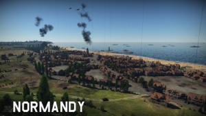
|[[File:MapIcon Ground Normandy.jpg|300x300px|border|link=]] | |[[File:MapIcon Ground Normandy.jpg|300x300px|border|link=]] | ||
| − | | style="vertical-align:top" |[[File:CountryIcon FRA.png|link=|top]] <span style="font-size: 18px; font-weight: 800;"> | + | | style="vertical-align:top" |[[File:CountryIcon FRA.png|link=|top]] <span style="font-size: 18px; font-weight: 800;">Нормандия</span><br>Расположение: Вьерви́ль-сюр-Мер , Франция<br> |
Operation Neptune is in full play, the Allies are advancing into the depths of Normandy but German forces are mounting a counterattack.<br> | Operation Neptune is in full play, the Allies are advancing into the depths of Normandy but German forces are mounting a counterattack.<br> | ||
|- | |- | ||
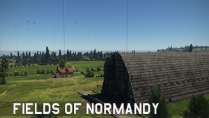
|[[File:MapIcon Ground FieldsofNormandy.jpg|300x300px|border|link=]] | |[[File:MapIcon Ground FieldsofNormandy.jpg|300x300px|border|link=]] | ||
| − | | style="vertical-align:top" |[[File:CountryIcon FRA.png|link=|top]] <span style="font-size: 18px; font-weight: 800;"> | + | | style="vertical-align:top" |[[File:CountryIcon FRA.png|link=|top]] <span style="font-size: 18px; font-weight: 800;">Поля Нормандии</span><br>Расположение: Вьерви́ль-сюр-Мер, Франция<br> |
[Description]<br> | [Description]<br> | ||
|- | |- | ||
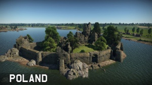
|[[File:MapIcon Ground Poland.jpg|300x300px|border|link=]] | |[[File:MapIcon Ground Poland.jpg|300x300px|border|link=]] | ||
| − | | style="vertical-align:top" |[[File:CountryIcon POL.png|link=|top]] <span style="font-size: 18px; font-weight: 800;"> | + | | style="vertical-align:top" |[[File:CountryIcon POL.png|link=|top]] <span style="font-size: 18px; font-weight: 800;">Польша</span><br>Расположение: Польша<br> |
German army is retreating into the depths of Europe, but still holding the field. Soviet forces are spoiling for a fight — victory is near at hand!<br> | German army is retreating into the depths of Europe, but still holding the field. Soviet forces are spoiling for a fight — victory is near at hand!<br> | ||
|- | |- | ||
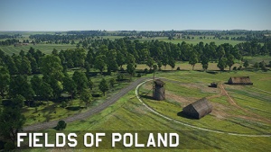
|[[File:MapIcon Ground FieldsofPoland.jpg|300x300px|border|link=]] | |[[File:MapIcon Ground FieldsofPoland.jpg|300x300px|border|link=]] | ||
| − | | style="vertical-align:top" |[[File:CountryIcon POL.png|link=|top]] <span style="font-size: 18px; font-weight: 800;"> | + | | style="vertical-align:top" |[[File:CountryIcon POL.png|link=|top]] <span style="font-size: 18px; font-weight: 800;">Поля Польши</span><br>Расположение: Польша<br> |
[Description]<br> | [Description]<br> | ||
|- | |- | ||
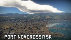
|[[File:MapIcon Ground PortNovorossiysk.jpg|300x300px|border|link=]] | |[[File:MapIcon Ground PortNovorossiysk.jpg|300x300px|border|link=]] | ||
| − | | style="vertical-align:top" |[[File:CountryIcon SUN.png|link=|top]] <span style="font-size: 18px; font-weight: 800;"> | + | | style="vertical-align:top" |[[File:CountryIcon SUN.png|link=|top]] <span style="font-size: 18px; font-weight: 800;">Порт Новороссийск</span><br>Расположение: Новороссийск,Россия<br> |
[Description]<br> | [Description]<br> | ||
|- | |- | ||
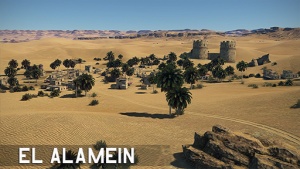
|[[File:MapIcon Ground ElAlamein.jpg|300x300px|border|link=]] | |[[File:MapIcon Ground ElAlamein.jpg|300x300px|border|link=]] | ||
| − | | style="vertical-align:top" |[[File:CountryIcon GBR.png|link=|top]] <span style="font-size: 18px; font-weight: 800;"> | + | | style="vertical-align:top" |[[File:CountryIcon GBR.png|link=|top]] <span style="font-size: 18px; font-weight: 800;">Вторая битва при Эль-Аламейне</span><br>Расположение: Эль-Аламейн,Египет<br> |
After stalling successfully the Axis advance into Egypt, the British forces initiated the offensive to gain control over the region.<br> | After stalling successfully the Axis advance into Egypt, the British forces initiated the offensive to gain control over the region.<br> | ||
|- | |- | ||
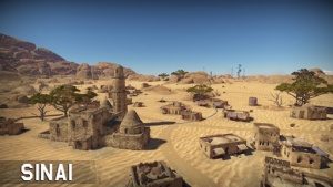
|[[File:MapIcon Ground Sinai.jpg|300x300px|border|link=]] | |[[File:MapIcon Ground Sinai.jpg|300x300px|border|link=]] | ||
| − | | style="vertical-align:top" |[[File:CountryIcon GBR.png|link=|top]] <span style="font-size: 18px; font-weight: 800;"> | + | | style="vertical-align:top" |[[File:CountryIcon GBR.png|link=|top]] <span style="font-size: 18px; font-weight: 800;">Синай</span><br>Расположение: Суэцкий канал, Египет<br> |
[Description]<br> | [Description]<br> | ||
|- | |- | ||
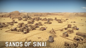
|[[File:MapIcon Ground SandsofSinai.jpg|300x300px|border|link=]] | |[[File:MapIcon Ground SandsofSinai.jpg|300x300px|border|link=]] | ||
| − | | style="vertical-align:top" |[[File:CountryIcon GBR.png|link=|top]] <span style="font-size: 18px; font-weight: 800;"> | + | | style="vertical-align:top" |[[File:CountryIcon GBR.png|link=|top]] <span style="font-size: 18px; font-weight: 800;">Пески Синая</span><br>Расположение: Суэцкий канал, Египет<br> |
[Description]<br> | [Description]<br> | ||
|- | |- | ||
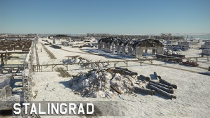
|[[File:MapIcon Ground Stalingrad.jpg|300x300px|border|link=]] | |[[File:MapIcon Ground Stalingrad.jpg|300x300px|border|link=]] | ||
| − | | style="vertical-align:top" |[[File:CountryIcon SUN.png|link=|top]] <span style="font-size: 18px; font-weight: 800;"> | + | | style="vertical-align:top" |[[File:CountryIcon SUN.png|link=|top]] <span style="font-size: 18px; font-weight: 800;">Сталинград</span><br>Расположение: Волгоград, Россия |
[Description]<br> | [Description]<br> | ||
|- | |- | ||
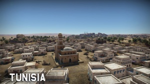
|[[File:MapIcon Ground Tunisia.jpg|300x300px|border|link=]] | |[[File:MapIcon Ground Tunisia.jpg|300x300px|border|link=]] | ||
| − | | style="vertical-align:top" |[[File:CountryIcon FRA.png|link=|top]] <span style="font-size: 18px; font-weight: 800;"> | + | | style="vertical-align:top" |[[File:CountryIcon FRA.png|link=|top]] <span style="font-size: 18px; font-weight: 800;">Тунис</span><br>Расположение: Габес, Тунис<br> |
[Description]<br> | [Description]<br> | ||
|- | |- | ||
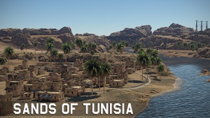
|[[File:MapIcon Ground SandsofTunisia.jpg|300x300px|border|link=]] | |[[File:MapIcon Ground SandsofTunisia.jpg|300x300px|border|link=]] | ||
| − | | style="vertical-align:top" |[[File:CountryIcon FRA.png|link=|top]] <span style="font-size: 18px; font-weight: 800;"> | + | | style="vertical-align:top" |[[File:CountryIcon FRA.png|link=|top]] <span style="font-size: 18px; font-weight: 800;">Пески Туниса</span><br>Расположение: Габес,Тунис<br> |
[Description]<br> | [Description]<br> | ||
|- | |- | ||
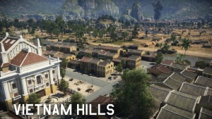
|[[File:MapIcon Ground VietnamHills.jpg|300x300px|border|link=]] | |[[File:MapIcon Ground VietnamHills.jpg|300x300px|border|link=]] | ||
| − | | style="vertical-align:top" |[[File:CountryIcon VNM.png|link=|top]] <span style="font-size: 18px; font-weight: 800;"> | + | | style="vertical-align:top" |[[File:CountryIcon VNM.png|link=|top]] <span style="font-size: 18px; font-weight: 800;">Вьетнам</span><br>Расположение: Хойан, Вьетнам<br> |
[Description]<br> | [Description]<br> | ||
|- | |- | ||
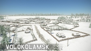
|[[File:MapIcon Ground Volokolamsk.jpg|300x300px|border|link=]] | |[[File:MapIcon Ground Volokolamsk.jpg|300x300px|border|link=]] | ||
| − | | style="vertical-align:top" |[[File:CountryIcon SUN.png|link=|top]] <span style="font-size: 18px; font-weight: 800;"> | + | | style="vertical-align:top" |[[File:CountryIcon SUN.png|link=|top]] <span style="font-size: 18px; font-weight: 800;">Волокаламск</span><br>Расположение: Волоколамск, Россия<br> |
[Description]<br> | [Description]<br> | ||
|- | |- | ||
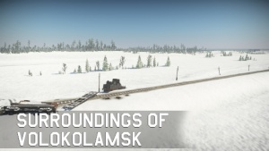
|[[File:MapIcon Ground SurroundingsofVolokolamsk.jpg|300x300px|border|link=]] | |[[File:MapIcon Ground SurroundingsofVolokolamsk.jpg|300x300px|border|link=]] | ||
| − | | style="vertical-align:top" |[[File:CountryIcon SUN.png|link=|top]] <span style="font-size: 18px; font-weight: 800;"> | + | | style="vertical-align:top" |[[File:CountryIcon SUN.png|link=|top]] <span style="font-size: 18px; font-weight: 800;">Пригород Волоколамска</span><br>Расположение: Волоколамск, Россия<br> |
[Description]<br> | [Description]<br> | ||
|- | |- | ||
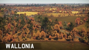
![[File:MapIcon Ground Wallonia.jpg|300x300px|border|link=]] | ![[File:MapIcon Ground Wallonia.jpg|300x300px|border|link=]] | ||
| − | | style="vertical-align:top" |[[File:CountryIcon BEL.png|link=|top]] <span style="font-size: 18px; font-weight: 800;"> | + | | style="vertical-align:top" |[[File:CountryIcon BEL.png|link=|top]] <span style="font-size: 18px; font-weight: 800;">Валлония</span><br>Расположение: Бастонь, Бельгия<br> |
[Description]<br> | [Description]<br> | ||
|- | |- | ||
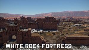
|[[File:MapIcon Ground WhiteRockFortress.jpg|300x300px|border|link=]] | |[[File:MapIcon Ground WhiteRockFortress.jpg|300x300px|border|link=]] | ||
| − | | style="vertical-align:top" |[[File:CountryIcon SUN.png|link=|top]] <span style="font-size: 18px; font-weight: 800;"> | + | | style="vertical-align:top" |[[File:CountryIcon SUN.png|link=|top]] <span style="font-size: 18px; font-weight: 800;">"Крепость Белая скала"</span><br>Расположение: Brest, Belarus |
The White Rock Fortress initially was built to protect the river. But as the river swallowed the fortress lost its meaning and in course of time was <br> | The White Rock Fortress initially was built to protect the river. But as the river swallowed the fortress lost its meaning and in course of time was <br> | ||
abandoned; only the storage buildings remained in use. As the war began the fortress was manned again and reconditioning works started. However, nothing <br> | abandoned; only the storage buildings remained in use. As the war began the fortress was manned again and reconditioning works started. However, nothing <br> | ||
Версия 00:46, 8 марта 2021
Карты сухопутных войск
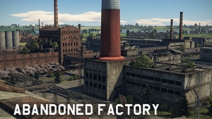 |
Расположение: Россия [All Descriptions need expanding] |
|---|---|
|
 Переправа через Рейн Переправа через РейнРасположение: Кёльн, Германия Teams fight for control over the bridges leading to the other side of the Rhine. |
|
Расположение: Аляска, США [Description] |
|
Расположение: Аризона, США [Description] |
|
Расположение: Бастонь, Бельгия [Description] |
|
Расположение: Ирландия A battle between two armies spread across the ground, the sea and the air. Thousands of people are fighting for control of the cliff-filled coast. |
|
Хюртгенский лес Расположение: Аахен, Германия Teams fight for control over a strategically important point located in Hürtgen Forest. |
|
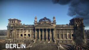
Берлин Расположение: Берлин, Германия [Description] |
|
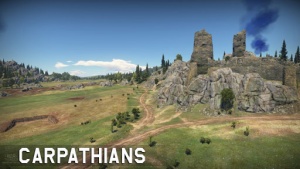
Расположение: Польша Two armies ran into a fight for possession of the mountain pass. |
|
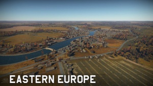
Расположение: Украина Warring armies are spoiling for a fight. only a small town is dividing them. It seems that no stone will be left unturned. |

|
Расположение: Украина |
|
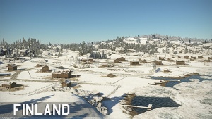
Расположение: Кивиниеми, до войны в Финляндии (Лосево, Современная Россия) In these frosty parts of the world, a war is like a stern test that needs to be passed in order to win. |
|
Ледяной перевал Расположение: Австрия [Description] |
|
Расположение: Гессен, Германия [Description] |
|
Расположение: Калабрия, Италия [Description] |
|
Расположение: Япония The beautiful rual countryside of japan, explore the fruitful cherry blossoms. |
|
Расположение: Гуадалканал , Соломоновские острова [Description] |
|
Расположение: Карелия, Россия [Description] |
|
Расположение: Северная Корея [Description] |
|
Расположение: Крымск, Россия [Description] |
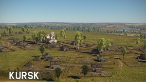
|
Расположение: Прохоровка, Россия [Description] |
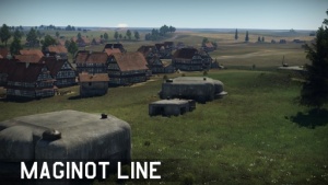
|
Расположение: Седан, Франция [Description] |
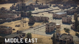
|
Расположение: Сирия [Description] |
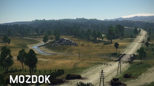
|
Расположение: Моздок, Россия [Description] |
|
Расположение: Вьерви́ль-сюр-Мер , Франция Operation Neptune is in full play, the Allies are advancing into the depths of Normandy but German forces are mounting a counterattack. |
|
Расположение: Вьерви́ль-сюр-Мер, Франция [Description] |
|
Расположение: Польша German army is retreating into the depths of Europe, but still holding the field. Soviet forces are spoiling for a fight — victory is near at hand! |
|
Расположение: Польша [Description] |
|
Расположение: Новороссийск,Россия [Description] |
|
Расположение: Эль-Аламейн,Египет After stalling successfully the Axis advance into Egypt, the British forces initiated the offensive to gain control over the region. |
|
Расположение: Суэцкий канал, Египет [Description] |
|
Расположение: Суэцкий канал, Египет [Description] |
|
Расположение: Волгоград, Россия [Description] |
|
Расположение: Габес, Тунис [Description] |
|
Расположение: Габес,Тунис [Description] |
|
Расположение: Хойан, Вьетнам [Description] |
|
Расположение: Волоколамск, Россия [Description] |
|
Расположение: Волоколамск, Россия [Description] |
|
Расположение: Бастонь, Бельгия [Description] |
|
Расположение: Brest, Belarus The White Rock Fortress initially was built to protect the river. But as the river swallowed the fortress lost its meaning and in course of time was |
Эта категория в данный момент пуста.

